Beskrivelse
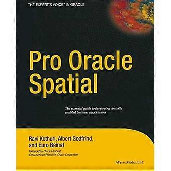
Pro Oracle Spatial
1 Overview. - 1 Spatial Information Management. - 2 Overview of Oracle Spatial. - 3 Location-Enabling Your Applications. - 2 Basic Spatial. - 4 The SDO_GEOMETRY Data Type. - 5 Loading Transporting and Validating Spatial Data. - 6 Geocoding. - 7 Manipulating SDO_GEOMETRY in Application Programs. - 3 Analysis and Visualization. - 8 Spatial Indexes and Operators. - 9 Geometry Processing Functions. - 10 Network Modeling. - 11 Generating Maps Using MapViewer. - 12 A Sample Application. - 4 Advanced Spatial. - 13 Case Studies. - 14 Tips Common Mistakes and Common Errors. - Appendix A Additional Spatial Analysis Functions. - Tiling-Based Analysis. - TILED_BINS. - TILED_AGGREGATES. - Neighborhood Analysis. - AGGREGATES_FOR_GEOMETRY. - AGGREGATES_FOR_LAYER. - Clustering Analysis. - SPATIAL_CLUSTERS. - Refining the Candidates for Site Selection. - Geometry Simplification for Speeding Up Analysis. - Summary. - Appendix B Linear Referencing. - Concepts and Definitions. - Measure. - Linear Referenced Segments. - Direction. - Shape Points. - Offset. - Typical Application. - Creating Linear Referenced Geometries. - SDO_GTYPE in LRS Geometries. - Constructing LRS Geometries. - Metadata. - Spatial Indexes and Spatial Operators on LRS Geometries. - Dynamic Segmentation Operations. - Clip a Segment. - Locate a Point. - Project a Point. - Validation of LRS Segments. - Dynamic Segmentation on 3D Geometries. - Other Operations. - Summary. - Appendix C Topology Data Model in Oracle. - Topology Data Model. - Benefits of the Topology Data Model. - Storing a Topology Data Model in Oracle. - Operating on a Topology in Oracle. - Creating a Topology. - Associating a Feature Layer with a Topology. - Inserting Updating and Populating Feature Layers. - Updating Topological Elements. - Querying for Topological Relationships. - Hierarchical Feature Model. -Summary. - Appendix D Storing Raster Data in Oracle. - SDO_GEORASTER Data Type. - Storage for SDO_GEORASTER Data. - Metadata in SDO_GEORASTER Data. - Populating SDO_GEORASTER Columns. - Manipulating Raster Objects. - Generating Pyramids. - Subsetting. - Georeferencing. - Visualizing Raster Data in Oracle MapViewer. - Summary. Language: English
-
Brand:
Unbranded
-
Kategori:
Computer og internet
-
Format:
Paperback
-
Forlag / Pladeselskab:
Apress
-
Udgivelsesdato:
2013/05/28
-
Kunstner:
Ravikanth Kothuri
-
Sprog:
English
-
Antal sider:
712
-
Fruugo ID:
337819012-741477562
-
ISBN:
9781430253051
Levering og returnering
Sendt inden for 4 dage
Afsendes fra Storbritannien.
Vi gør vores bedste for at sikre, at de produkter, du bestiller, leveres til dig fuldt ud og i henhold til dine specifikationer. Skulle du dog modtage en ufuldstændig ordre eller andre ting end dem, du bestilte, eller der er en anden grund til, at du ikke er tilfreds med ordren, kan du returnere ordren eller produkter inkluderet i ordren og modtage en fuld refusion for varerne. Se fuld returpolitik

